
Discovering Earth's History
History 388T
Images
Map - Rhine River System
Newport News Coal Terminal
Selestat Mammoth
Marienglas
Marienglashöhle
Freiburg Fish
Alexander von Humboldt
Wilhelm von Humboldt
Humboldt Itinerary
Tenerife - volcanic
Tenerife map
Dragon Tree
Pico del Teide
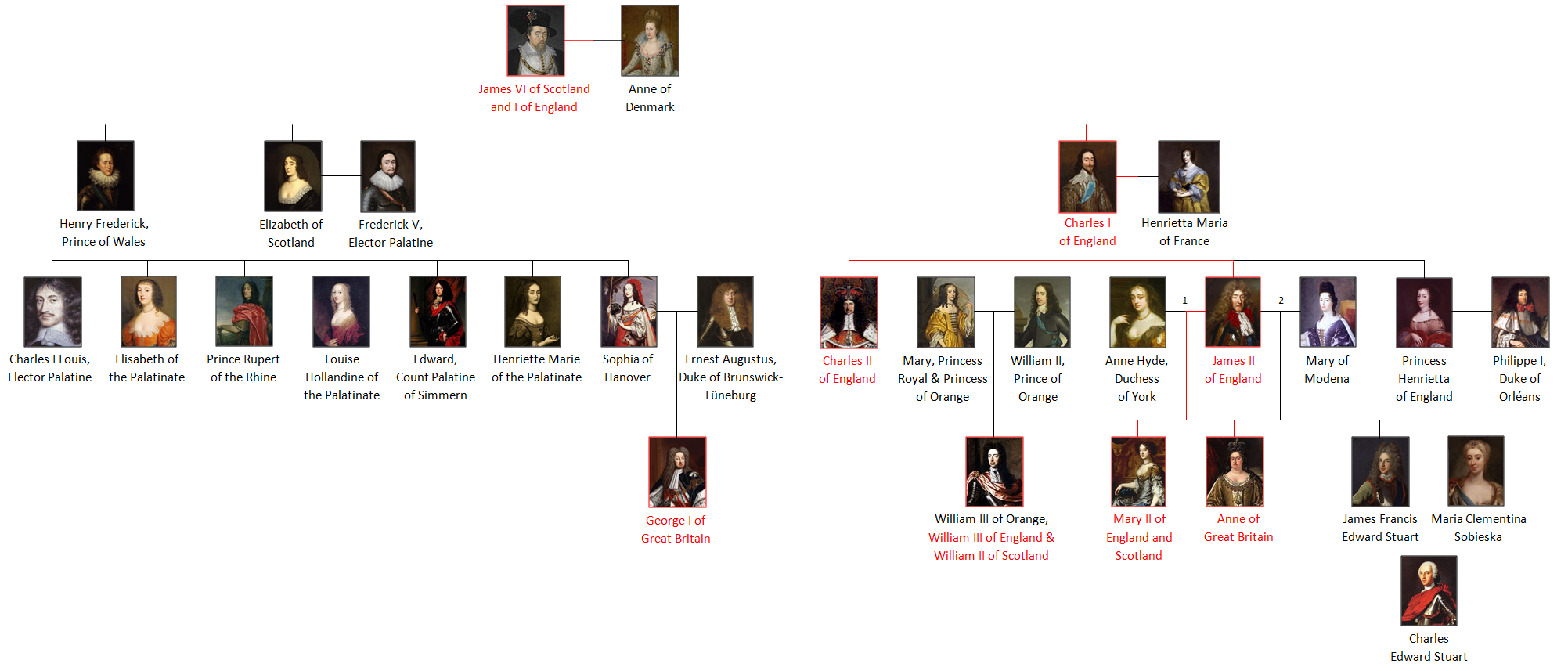
Stuart genealogy
Harz map
Leibniz, Protogaea, tab.2
Shark tooth
Steno, shark & teeth
Argentina map
Punta Alta cliffs
Megatherium
Toxodon
Mastodon
Ptolemaic worldview
elements & humors
planetary retrograde motion
eccentric, epicyclic, equant
Map - Tierra del Fuego
J. G. Lehmann, section Thuringen (1759)
Table of geological time
Scotland
Gibralter
Lammermuir Hills
Jedburgh
Siccar Point
Siccar Point, labeled
Linnaeus, Hortus Cliffortiana (1737)
map - Europe physical
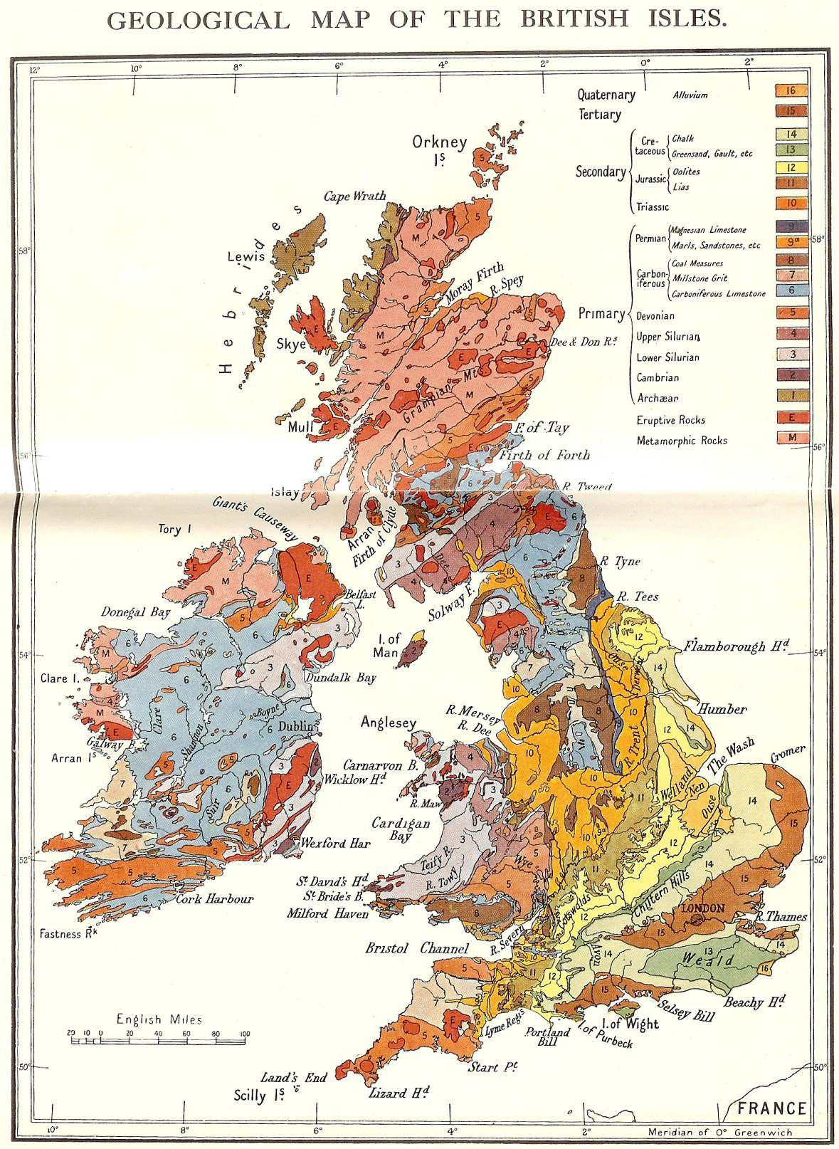
map - Europe geology
map - Great Britain geology
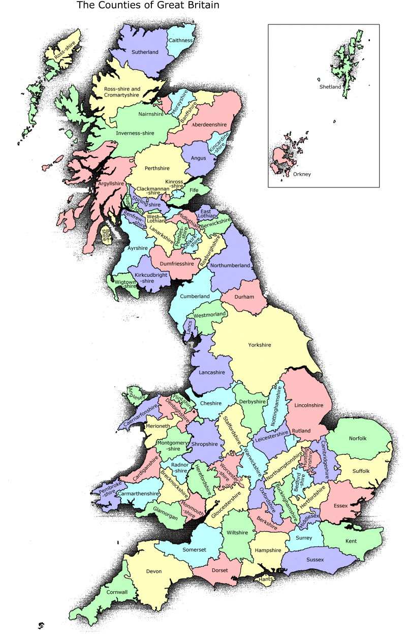
map - Great Britain counties
Deshayes Table of Shells (Lyell, vol.3) - (2pg-view)
Great Salt Lake & Stansbury
Mts.
oolitic sand
Pequop Summit, Nevada
Cookie Monster
No Physicist is An Island (NY Times, 2013)
Pigeons (Darwin, Species, ch.9)
Texts
Athanasius Kircher, S.J., Mundus Subterraneus, vol. 2 (Amsterdam: J. Jansson, 1664).
James Hutton, "Theory of the Earth," Transactions of the Royal Society of Edinburgh 1 (1788): Part 2, pp.209-304.
Abstract here.
Sedgwick & Murchison, "Classification of the Older Stratified Rocks of Devonshire & Cornwall," Philosophical Magazine & Journal of Science, ser.3, vol.14 (April 1839): 241-60. (.pdf)
Sedgwick & Murchison, "Classification of the Old Slate Rocks of the North of Devonshire," BAAS Transactions (1838): 95-96.
Humboldt
- Atlas (Stanford, David Rumsey Map Collection)
- A.v.H.de (... | digitalisate)
- dragon tree of La Orotava (Midas sign-in)
- Picturesque Atlas, pl. 54 (South Carolina)
Darwin
Lyell