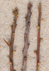
M. heterophylla, left; M. cerifera, right. Blackwater Ecological Preserve, Zuni, VA. 36.818067 degrees N, 76.855302 degrees W. 30 October 2010
Center: Morella pennsylvanica. Outside: M. cerifera. Kiptopeke State Park, Northampton County, VA. 37.165642 degrees N, 75.983378 degrees W. 9 March 2011
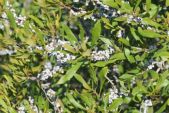
Campus, Norfolk, Virginia. 6 April 2010
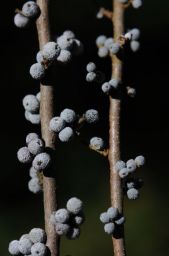
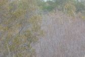
Aransas National Wildlife Refuge, Aransas County, Texas. 21 October 2014. Maritime forest. 28°16'24.4" North, 96°48'28.8" West (28.273443, -96.807988)
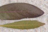
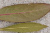
Top: Morella pennsylvanica. Bottom: M. cerifera. Kiptopeke State Park, Northampton County, VA. 37.165457 degrees N, 75.983915 degrees W. 9 March 2011
Left: Morella cerifera. Right: M. pennsylvanica. Kiptopeke State Park, Northampton County, VA. 37.165240 degrees N, 75.984053 degrees W. 9 March 2011
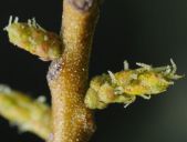
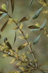
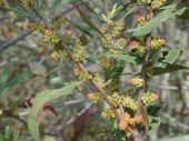
Bayberry. Male flowers.
Morella pennsylvanica, left; M. cerifera, right. Prime Hook National Wildlife Refuge, Delaware. 22 September 2010
April 2004. Parkers Ferry, Hertford County, North Carolina
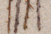
1,3: Morella cerifera. 2,4: M. pennsylvanica. Kiptopeke State Park, Northampton County, VA. 37.165642 degrees N, 75.983378 degrees W. 9 March 2011
Top: Morella pennsylvanica. Bottom: M. cerifera. Kiptopeke State Park, Northampton County, VA. 37.165450 degrees N, 75.983890 degrees W. 9 March 2011